


Tête de Pibossan

Arnaud Stévenard
User
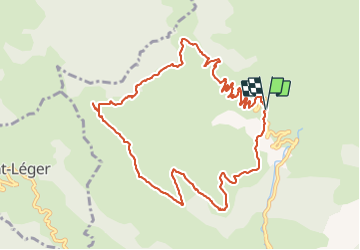

Length
12.2 km

Max alt
1617 m

Uphill gradient
760 m
Km-Effort
22 km

Min alt
871 m

Downhill gradient
762 m
Boucle
Yes
Creation date :
2021-10-10 07:18:21.0
Updated on :
2021-10-10 13:49:14.677
6h30
Difficulty : Easy

FREE GPS app for hiking
 SityTrail
IGN / Geographical institutes
SityTrail Plus
The world is yours!
About
Trail Walking of 12.2 km to be discovered at Provence-Alpes-Côte d'Azur, Maritime Alps, La Croix-sur-Roudoule. This trail is proposed by Arnaud Stévenard.
Positioning
Country:
France
Region :
Provence-Alpes-Côte d'Azur
Department/Province :
Maritime Alps
Municipality :
La Croix-sur-Roudoule
Location:
Unknown
Start:(Dec)
Start:(UTM)
329357 ; 4874976 (32T) N.
Comments